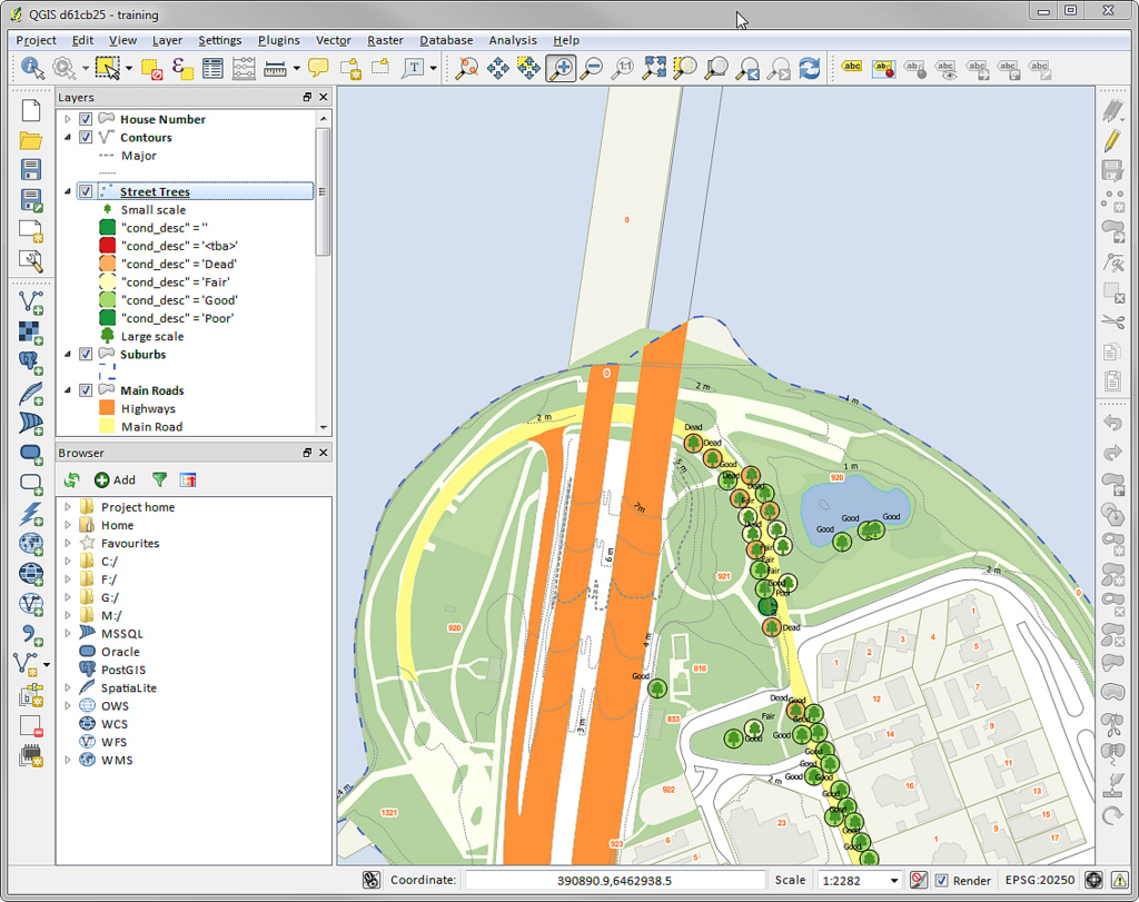
Overview of QGIS Manipulating Tables |
QGIS is emerging as an open source leader for mapping. Learn QGIS and help your office save costs using the free, open source QGIS mapping software. You can install QGIS for free on Windows, Max OS X and Linux. QGIS will allow you to work with ESRI/ArcMap files and read and write ESRI File Gdb's as well as KML/KMZ, and GPX. You can read and write ESRI shapefiles, MapInfo and MicroStation file formats, AutoCAD DXF, PostGIS, SpatiaLite, Oracle Spatial and MSSQL Spatial databases, and many more data formats.
This course will get you started with QGIS. QGIS makes GIS software (which is traditionally expensive proprietary software) a viable prospect for anyone with basic access to a personal computer.
This 3-day hands-on class introduces participants to environmental applications of QGIS for maps and spatial analyses. The course will start with general concepts and vocabulary to form a comprehensive overview of QGIS functions and uses in the environmental field. Each participant will use their own laptop to create, edit, display and analyze real world environmental data during numerous hands-on exercises. On the third day, participants will have an opportunity to expand their skills by applying their knowledge to more complex and in-depth projects.
After completing this course, participants will be able to:
Continuing Education Units: 2.00 CEUs
Basic understanding of computer operations.
Attendees will receive a course workbook containing workshop proceedings and reference material.
This hands-on course is intended for environmental and graphics professionals involved in the collection, interpretation, and presentation of spatially related data and mapping. Previous GIS experience is not required
Overview of QGIS Manipulating Tables |
Drinks and snacks will be provided each day. Lunch will be on your own.
Click here to be notified when this course is scheduled in your area. Please note what state is most convenient for you.
Pacific Salmonids: Spawning Habitat Restoration
Boat Electrofishing: Principles and Practices
Backpack Electrofishing: Principles and Practices
Control and Management of Non-Native Invasive Fish
Boat-Backpack Electrofishing: Principles and Practices
Habitat Restoration Webinar Series: Planning and Implementing a Successful Restoration Plan
Collecting and Handling of Water Samples for Trace Metal Analysis
Environmental Forensics in Water Resources
Fundamental Contaminant Chemistry in Soil and Groundwater
Emerging Contaminants Workshop
Environmental Forensics-Site Characterization and Remediation
Comprehensive Environmental Sampling: Methodology, Practice, and Analysis
PFOS, PFAS, PFOA, and Emerging Contaminants
Chemistry Laboratory Techniques for the Chemist and Technician - A Comprehensive Review
Facilitation Skills For Environmental Professionals
Persuasive Communication and Presentation of Environmental Projects
Collaborative Negotiation Skills for Environmental Professionals
Conflict Resolution Skills for Environmental Professionals
Collaborative Negotiations and Conflict Management for Environmental Professionals
Effective Speaking When The Heat is On
Lean and Six Sigma for Environmental Professionals: Full Series Webinar Recording
Public Relations and Collaboration Challenges Intensive
Facilitating Online and Remote Meetings-Webinar RECORDED
Facilitation Skills and Collaborative Negotiation Training for Environmental Professionals
Managing Difficult Workplace Conversations
17½ Tips To Improve Your In-Person and Conference Call Meetings
Lean Thinking: Process Management Made Easy
Citizen Science Best Practices
Persuasive Online and Written Presentations: When Information is Not Enough
Conflict Resolution Quick Start: Get More Work Done by Resolving Conflicts Effectively
Foundations of Online Meetings: a Quick Start Guide for Effective and Efficient Video Conferencing
Persuasive Presentations Quick Start: Get Your Audience to Stop, Listen, and Act!
Oregon Erosion and Sediment Control 1200-C Permit Webinar
Tribal Environmental Regulation and Jurisdiction
Introduction to the California Environmental Quality Act (CEQA)
Model Toxics Control Act: An Introduction
New Approaches and Implementation Methods for Municipal Stormwater Management
NEPA: The Law, Logic, and Language of the National Environmental Policy Act
Industrial Stormwater Management Workshop
Advanced NEPA-An intensive one-day seminar with solutions to the most difficult NEPA problems
Natural Resource Damage Assessment Workshop
Writing a Quality Assurance Project Plan (QAPP)
NEPA: Writing and Evaluating an EIS or EA/FONSI
The Complete Legislative History of NEPA
Introduction To The National Environmental Policy Act (NEPA)
Principles of Quality Assurance and Quality Control in Environmental Field Programs
Introduction to Aquatic Toxicology
Planning and Preparing an Ecological Risk Assessment
New Approaches in Remediation of Contaminated Sediments
Brownfield Site Restoration and Remediation
Groundwater Contamination and Remediation: Principles and Practices
Ecological Risk Assessment-An Introduction: Webinar
Ecological Risk Assessment: Advanced Webinar
Assessing Contaminants in Subsistence Resources
Ecological Risk Assessment Series: Introduction and Advanced RECORDED
Establishing and Demonstrating Compliance with Sediment Cleanup Standards
ArcGIS PRO: Geoprocessing-Advanced Techniques for Environmental Applications
ArcGIS PRO: An Introduction to Environmental Applications
Visualizing and Analyzing Environmental Data with R
Advanced GIS Techniques for Fisheries Data Management and Analysis
Basic Statistics for Environmental Professionals
Microsoft Access Part 1: Introduction to Building Environmental Databases-WEBINAR
Microsoft Access Part 2: Creating Efficient Workflows and Custom Tools-WEBINAR
Microsoft Excel Up to Speed Part 1: Shortcuts, Functions, and Charts WEBINAR-RECORDED
Microsoft Excel Up to Speed Part 2: Analysis and Visual Basic Programming WEBINAR RECORDED
Microsoft Excel Up to Speed Parts 1 and 2
Microsoft Access Webinar Parts 1 and 2
Introduction to Environmental Applications with ArcGIS PRO
Evaluating Data Quality for Decision Making
Introduction to QGIS: An Alternative to ArcGIS
CESCL: Certified Erosion and Sediment Control Lead Training
EPA's New Unified Guidance: Statistical Analysis of Groundwater Monitoring Data
Achieving Water Quality Standards Through Contaminant Trackdown Studies
CESCL: Erosion and Sediment Control Lead Training 2-Day in Oregon
Waters of the United States Webinar-Recorded
Chemically Contaminated Drinking Water in the U.S.
Wetlands: Science and Regulatory Management
Chemically Contaminated Drinking Water in the U.S.-FREE DEMO RECORDING


© 2026 NWETC. All rights reserved